EOS2 Applications
Home and yard 3D scanning with LiDAR
Planning a shed, a remodel or a new office layout? The EOS2 LiDAR sensor scans your yard or interior in minutes and gives you a to-scale 3D point cloud to measure and design on, instead of a notebook full of tape-measure readings.
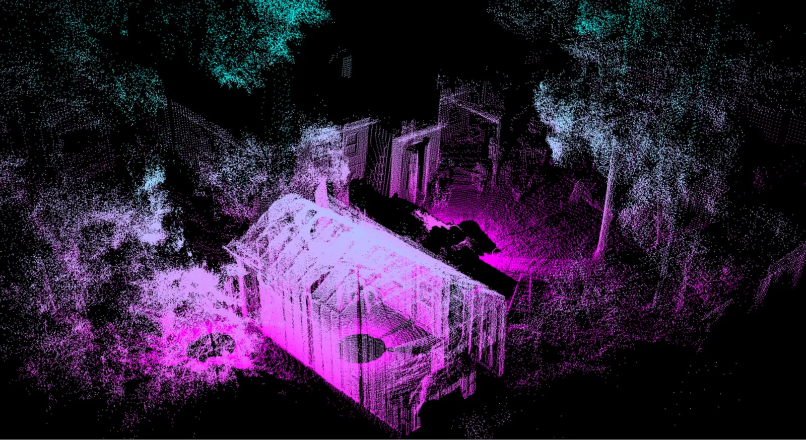
Digitize your home and yard
Why use home and yard 3D scanning?
A tape measure gives you one number at a time, and it is easy to miss the one you need later. A LiDAR scan captures the whole space at once: ground, walls, fences, trees and the house itself, from the ground up to the treetops. Take the measurements you need today and come back to the same data for the next project.
The EOS2 LiDAR sensor sweeps a full 360° x 180° sphere in about three minutes at 1° angular resolution, reaching 100–200 ft in every direction per position (200–400 ft across) depending on the surface. For a typical backyard or a floor of a house, a handful of scan positions merged together covers the whole area.
Projects
What you can do with a home scan
Three projects where a to-scale 3D model saves time and second-guessing.
Loading 3D model… (3.6 MB)
Backyard shed planning
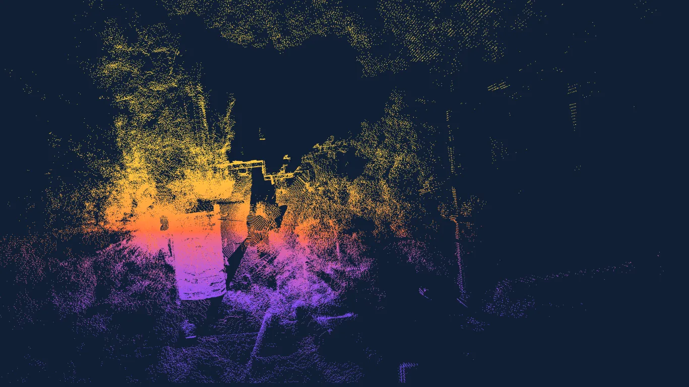
Before you order a wooden shed, you want to know where it fits, how far it sits from the house and fence, and how much the ground slopes. A backyard scan captures the terrain, the house and the existing trees in one to-scale model.
- Measure clearances between the house, trees and property features
- Check slope across the footprint before leveling a pad
- Try different positions on a digital canvas before digging
Renovation measurement
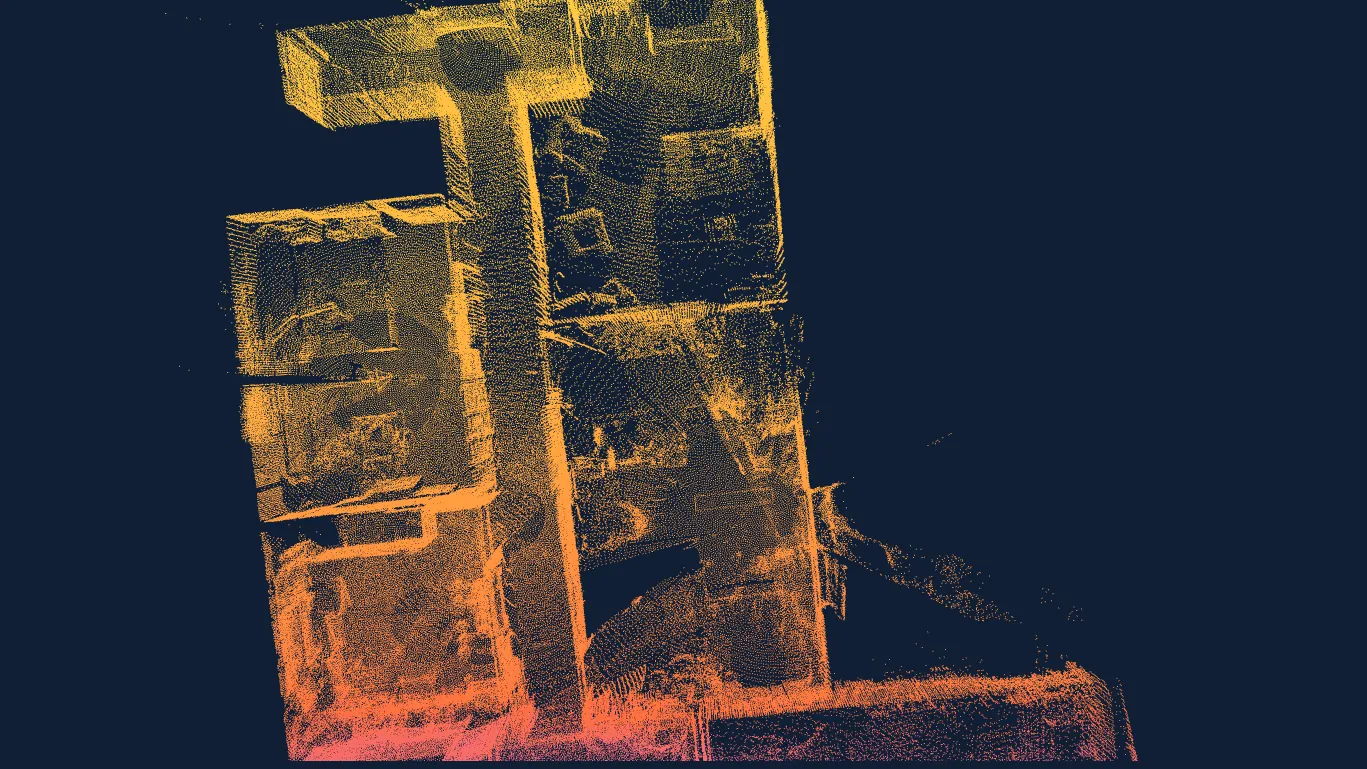
Remodels go wrong when a measurement is missing or wrong. Scan the rooms before work starts and you have wall lengths, ceiling heights and door and window openings in one dataset you can revisit whenever a new question comes up.
Share the model with a designer or contractor so everyone plans from the same geometry, and scan again after demolition to document what was behind the walls.
Interior and office scans
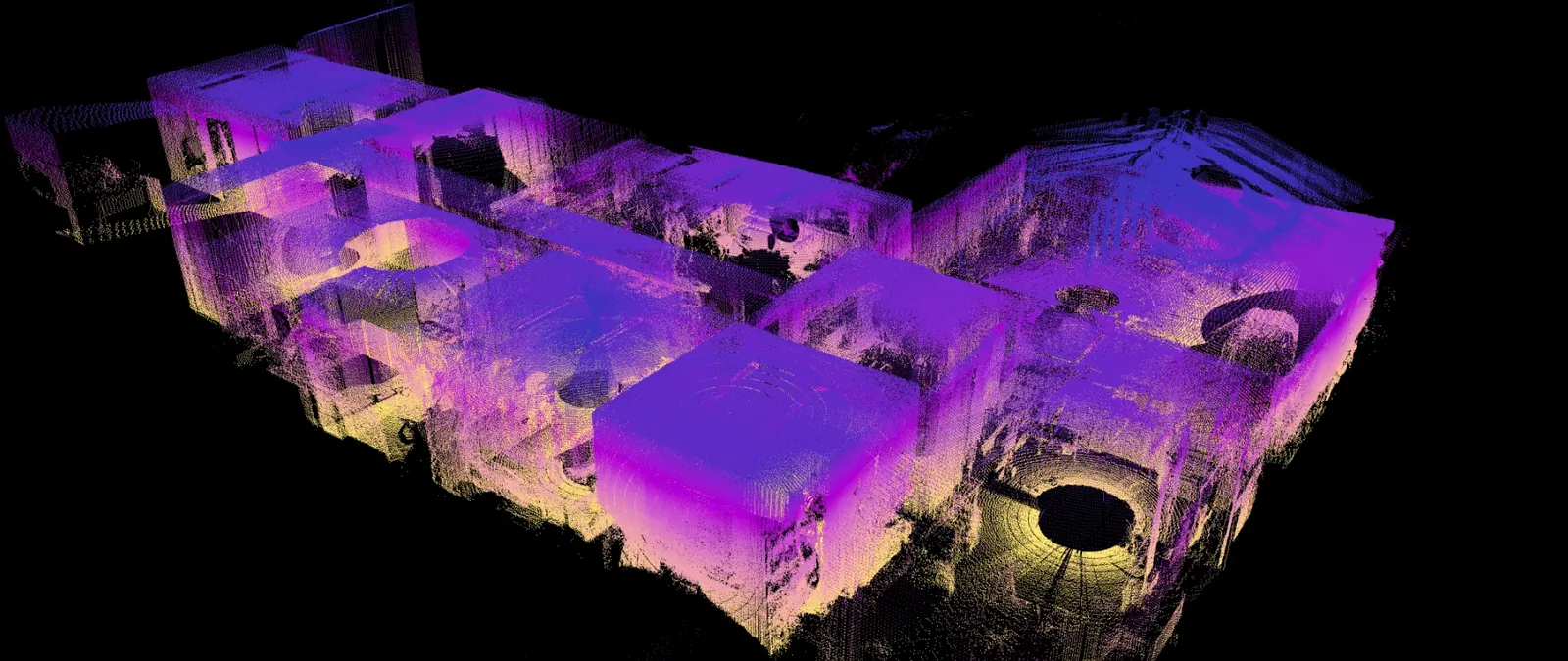
This point cloud is the actual interior of the Altamus office, captured with the EOS2 from several positions and merged. Room layouts, walls and furniture are all visible in one model.
An interior scan like this is a practical starting point for space planning, furniture layout, as-built documentation or creating 3D assets of a real space.
Workflow
How to capture and process a home scan
From setup to a measured 3D model in an afternoon.
Plan positions
Pick scan spots with clear lines of sight to the areas you care about. Overlap neighboring positions so the scans can be merged.
Set up and connect
Place the sensor on a stable surface or mount it by its 3/4" NPT fitting or the 1/4"-20 UNC thread on top, power it at 12 VDC and connect over Wi-Fi or Bluetooth with the companion app.
Scan
Each full spherical scan takes about three minutes. Move to the next position and repeat until the whole area is covered.
Merge and measure
Merge the scans into one point cloud, clean up stray points, then measure distances, heights and slopes in your software of choice.
No internet connection is required to scan. The EOS2 works locally through its companion application.
Tools
Export and process your point cloud
EOS2 scans are standard point clouds, so you are not locked into one program. Common options include:
- CloudCompare for aligning, cleaning, measuring and comparing scans
- MeshLab for turning a point cloud into a 3D mesh
- Blender for modeling a new shed, deck or room on top of the scan
- Unity and Unreal Engine for walk-through visualizations and VR
- Hyperion for cleaning, visualizing and measuring, including volumes such as a backyard excavation
Accuracy
What accuracy to expect
The EOS2 is specified at 1% rangefinder accuracy and 0.25° angular accuracy. Because range error scales with distance, results are best when you keep surfaces reasonably close to a scan position. For example, 1% of a 30 ft distance is about 3.6 inches.
That makes the EOS2 well suited to layout, clearance, slope and planning work around the home. For work that needs tighter tolerances, confirm critical dimensions on site before cutting or pouring.
| Field of view | 360° x 180° |
|---|---|
| Scan time | About 3 minutes at 1° resolution |
| Range per position | 100–200 ft radius (200–400 ft across), depending on surface visibility |
| Accuracy | 1% range, 0.25° angular |
| Connectivity | 2.4 GHz Wi-Fi, Bluetooth |
| Laser safety | Class 1, eye-safe |
Home scanning FAQ
Common questions about scanning your home and yard with the EOS2.
Each full spherical scan takes about three minutes. A typical backyard needs a few scan positions to see around the house, trees and other obstacles, so plan on several scans rather than one.
The EOS2 is specified at 1% rangefinder accuracy and 0.25° angular accuracy. That is well suited to planning, layout and clearance measurements. Confirm critical dimensions on site before cutting materials.
No internet connection is needed to scan: the EOS2 works locally through its companion application over Wi-Fi or Bluetooth. To view and measure your scans you can use free tools such as CloudCompare and MeshLab, or Altamus Hyperion.
Yes. The EOS2 has a full spherical field of view for interiors and an IP54 enclosure that is dust protected and resists splashing water outdoors. It is an eye-safe Class 1 laser, so it is safe to use around people.
The EOS2 is available to purchase for $2,750 per scanner with a 1-year hardware warranty, or to lease for $100 per scanner per month. See EOS2 pricing for details.
Contact
Plan your home scanning project
Tell us what you want to scan and we will help you choose the right setup and number of scan positions.
- +1 352-283-8003
- info@altamusinc.com
- 4936 SW 91st Ter M102
Gainesville, FL 32608