Stockpile Inventory Monitoring System
Hyperion: automated stockpile volumes you can trust
Hyperion delivers fast, accurate volumetric data for bulk materials across mining, construction, agriculture and heavy industry. Replace manual surveys with quality-assured 3D measurements, on demand or on a schedule.
What is Hyperion?
A modular system for reliable bulk inventory measurement
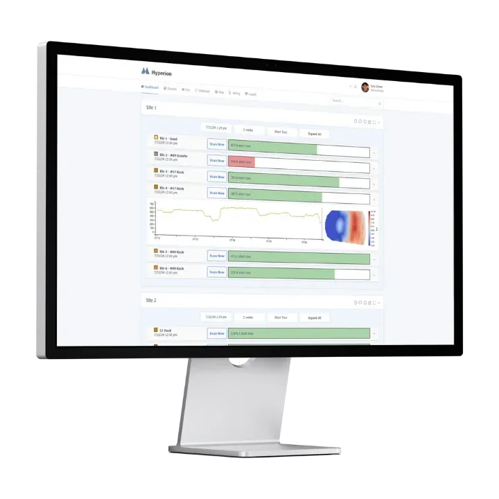
Hyperion is powered by proprietary software that calculates highly accurate volumes from 3D point clouds. It accepts data from external sources such as processed drone flights or other point-cloud scanners, and it performs best when paired with our EOS2 LiDAR sensor for fully automated scanning.
Our surface generation algorithm processes each scan, composites data from multiple scanners, filters out noise and equipment, and calculates precise volumes within minutes. Built-in quality assurance shows where data was missing and interpolated, and flags or discards periods of questionable accuracy, so you always know how much to trust a number.
I need this solution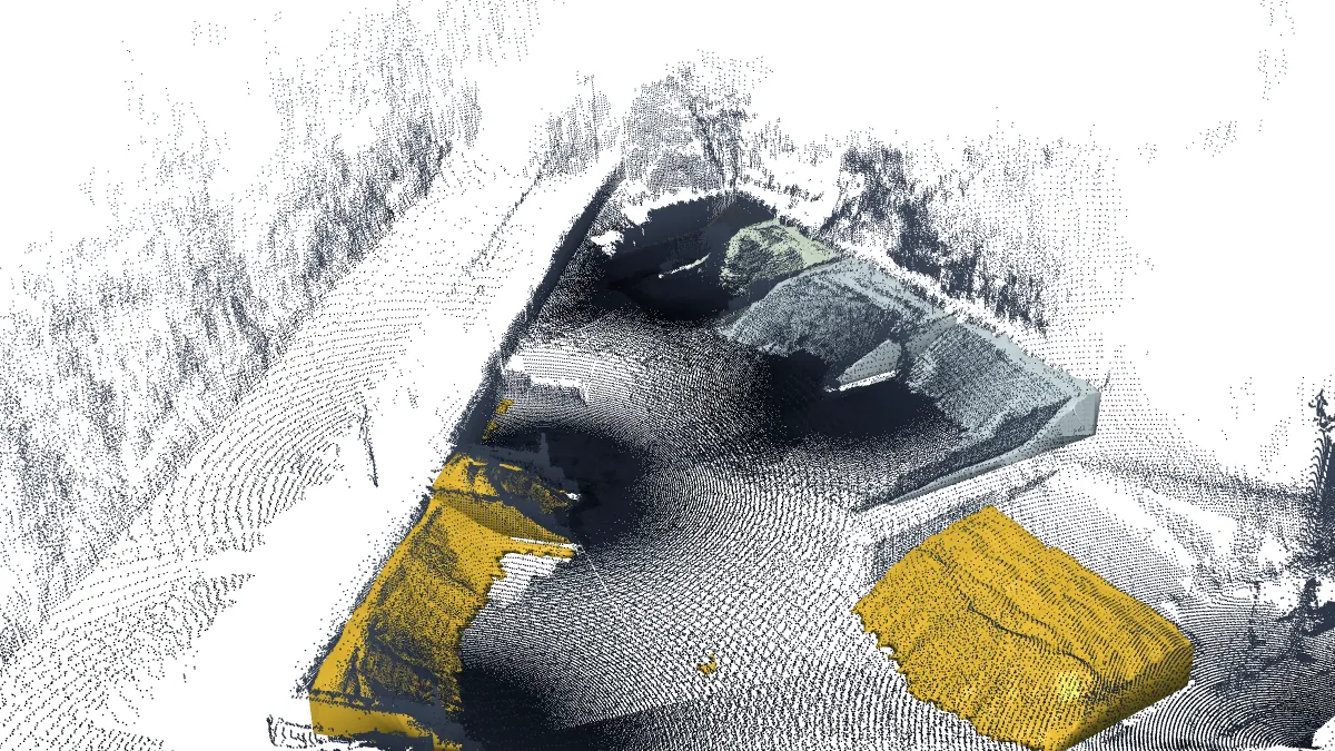
Loading 3D model… (14.7 MB)
Process
How Hyperion works
A fast, reliable path from raw point cloud to inventory report.
Data acquisition
Permanently mounted, eye-safe Class 1 EOS2 LiDAR scanners capture your piles on a schedule or on demand. Or import point clouds from drones and third-party scanners.
Processing
Point clouds are merged, registered and filtered automatically. Hyperion reconstructs the pile surface, computes volume and quality-checks the result in minutes.
Reporting
Results go to your dashboard or out through the API. Apply material densities for tonnage and reconcile inventory daily, or even per shift.
Benefits
Key benefits of Hyperion
Unmatched speed and accuracy in bulk inventory measurement, whether you manage a single stockpile or a complex multi-site operation.
Highly accurate volumetric data
Proprietary quality assurance shows where data is missing or interpolated and flags periods of questionable accuracy.
Visual interface
An intuitive dashboard for real-time monitoring and history: scan reports, 3D models, height maps and volume trends.
Modular and scalable
Combine multiple sensors or data sources to cover larger areas and expand coverage as your operation grows.
Automation ready
With EOS2 sensors, schedule scans hourly, daily or on demand, with no one on the pile.
Seamless data integration
Works with common geospatial formats and exports through an API to your inventory, ERP or BI platforms.
User access control
Assign roles and permissions so each team member sees exactly the data they need.
See it in action
Automated 3D scanning for stockpile monitoring
Watch Hyperion deliver fast, accurate, automated volume measurement with LiDAR. In minutes it generates precise 3D point clouds, visualizes inventory and supports better operational decisions, without manual effort.
Start a 90-day pilotVisualization
Visualize your inventory
Hyperion turns LiDAR data into clear, intuitive views of every pile.
Accurate 3D models
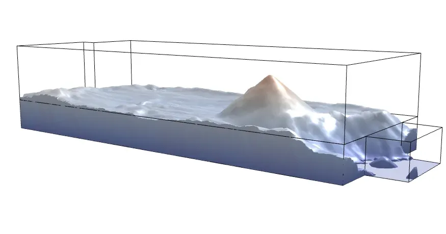
See the exact shape and volume of each pile in an automatically generated 3D mesh, a digital twin of your physical inventory. Identify irregularities, plan reclamation and verify deliveries with confidence.
Detailed height maps and scan history
Color-coded height maps show how material is distributed so you can spot high and low points, monitor pile geometry, and keep loader operations safe and efficient.
Every scan is kept, so each pile has a complete time series. Follow a pile's inventory on the timeline, then pick any past scan to see its height map and 3D model exactly as the pile stood at that moment. Compare dates side by side to see where material was added or reclaimed, check a delivery against the scan before and after it, and back up month-end numbers with the scan they came from.

Satellite map alignment
Hyperion brings up satellite map tiles of your site. When your sensors are geospatially referenced, each scanner's point cloud sits on the imagery at its real-world position, so you can line it up against the buildings, bay walls and roads you can see from above. Your scans end up in real-world coordinates that match your site plans, and adding another sensor later starts from the same map.
Pricing
Hyperion software pricing
Pricing is per facility. Please ask about bulk and multi-site pricing.
Entry
For operations that need occasional bulk inventory measurement.
- Automatic data: daily
- On-demand data: $2 per scan, per scanner
- Free Hyperion updates for life
Pro
For operations that need uninterrupted data for optimal efficiency.
- Automatic data: hourly
- On-demand data: free and unlimited
- Priority updates
- Integrated support
Automation features require the EOS2 LiDAR sensor (sold or leased separately). See deployment & support for installation options.
90-day pilot
Prove Hyperion on your own stockpiles before you commit
Run a 90-day pilot at your facility. Our team helps you plan the sensor layout, get set up and compare Hyperion's numbers with the way you measure inventory today.
- 90 days of Hyperion on your own materials and storage
- Help planning sensor placement and installation
- Side-by-side comparison with your current counts or surveys
- A results review with our team at the end of the pilot
Hyperion applications by industry
Hyperion FAQ
Answers to common questions about stockpile monitoring with Hyperion.
At a Newberry, Florida cement plant, Hyperion's mass estimate for an indoor coal stockpile came within 0.55% of a certified third-party terrestrial survey. Every scan is processed and quality-checked, and the software flags areas where data is missing or interpolated so you know how reliable each result is.
With EOS2 sensors, scans can run on demand or on a schedule (hourly, daily or custom intervals) depending on your plan. The Entry plan includes daily automatic data and the Pro plan includes hourly automatic data with unlimited on-demand scans.
Yes. Hyperion is modular. Deploy multiple sensors across your facility and the data is automatically merged and registered into one seamless view of your stockpiles.
Yes. Hyperion accepts point clouds from processed drone flights and other scanners, and it works with common geospatial file formats. Pairing it with EOS2 sensors adds fully automated, scheduled scanning.
Yes. Hyperion provides API access and exportable data formats to integrate with inventory management, ERP (such as SAP or JD Edwards) and reporting platforms.
Hyperion software starts at $100 per facility per month (Entry) or $500 per month (Pro). A 90-day pilot lets you prove it on your own stockpiles first. EOS2 hardware can be purchased or leased separately. Contact us for bulk pricing.
Contact
Talk to a Hyperion specialist
Tell us about your materials, storage layout and reporting needs, and we will recommend a sensor layout and plan.
- +1 352-283-8003
- info@altamusinc.com
- 4936 SW 91st Ter M102
Gainesville, FL 32608