EOS2 LiDAR Sensor
Affordable long-range 3D mapping with the EOS2 LiDAR sensor
The EOS2 is a long-range, spherical LiDAR sensor built for permanent indoor or outdoor installation. It captures a full 360° point cloud in about three minutes, draws little enough power to run on solar, and costs a fraction of traditional survey-grade scanners.
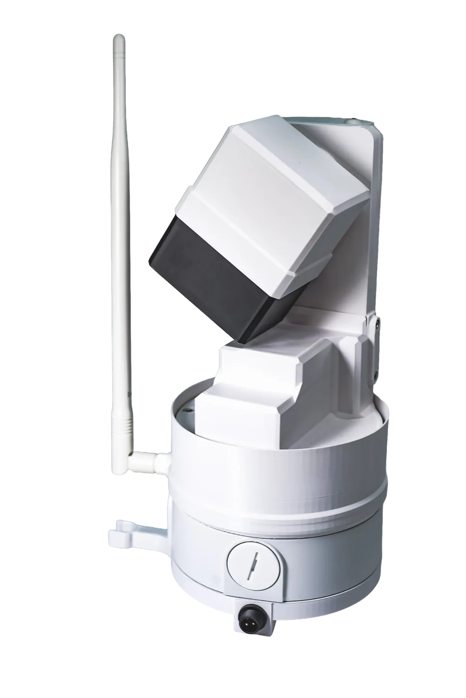
What is the EOS2?
A spherical LiDAR sensor that sees every angle
Long-range 3D scanning has long been blocked by six-figure equipment costs. The EOS2 LiDAR sensor was built to break that barrier for industrial operators, researchers and developers alike.
Instead of a fixed line of sight, the EOS2 uses a LiDAR rangefinder and high-precision stepper motors to rotate its measurement head through a complete sphere. The result is a dense point cloud covering a full 360° x 180° field of view, with no blind spots overhead or around the sensor.
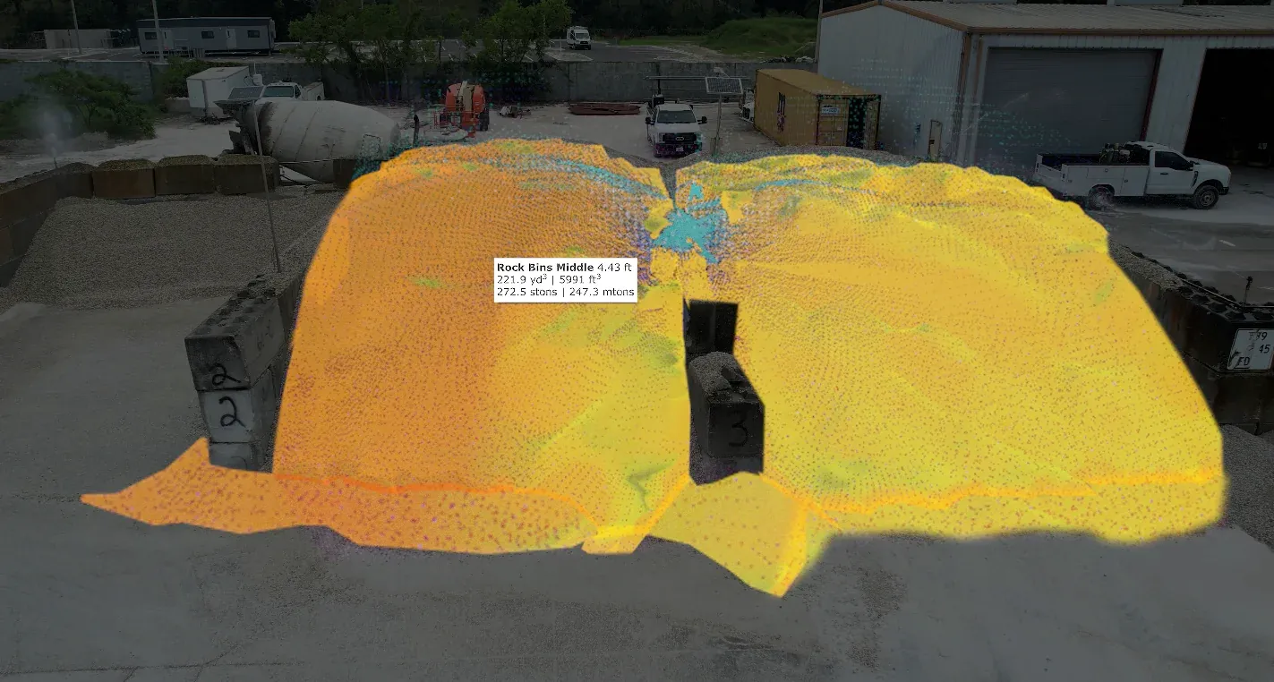
Each scan turns a physical space into a to-scale 3D digital twin that you can measure, compare over time and analyze. Paired with Hyperion stockpile monitoring software, those point clouds become automated inventory volumes and tonnages.
Acquire a sensor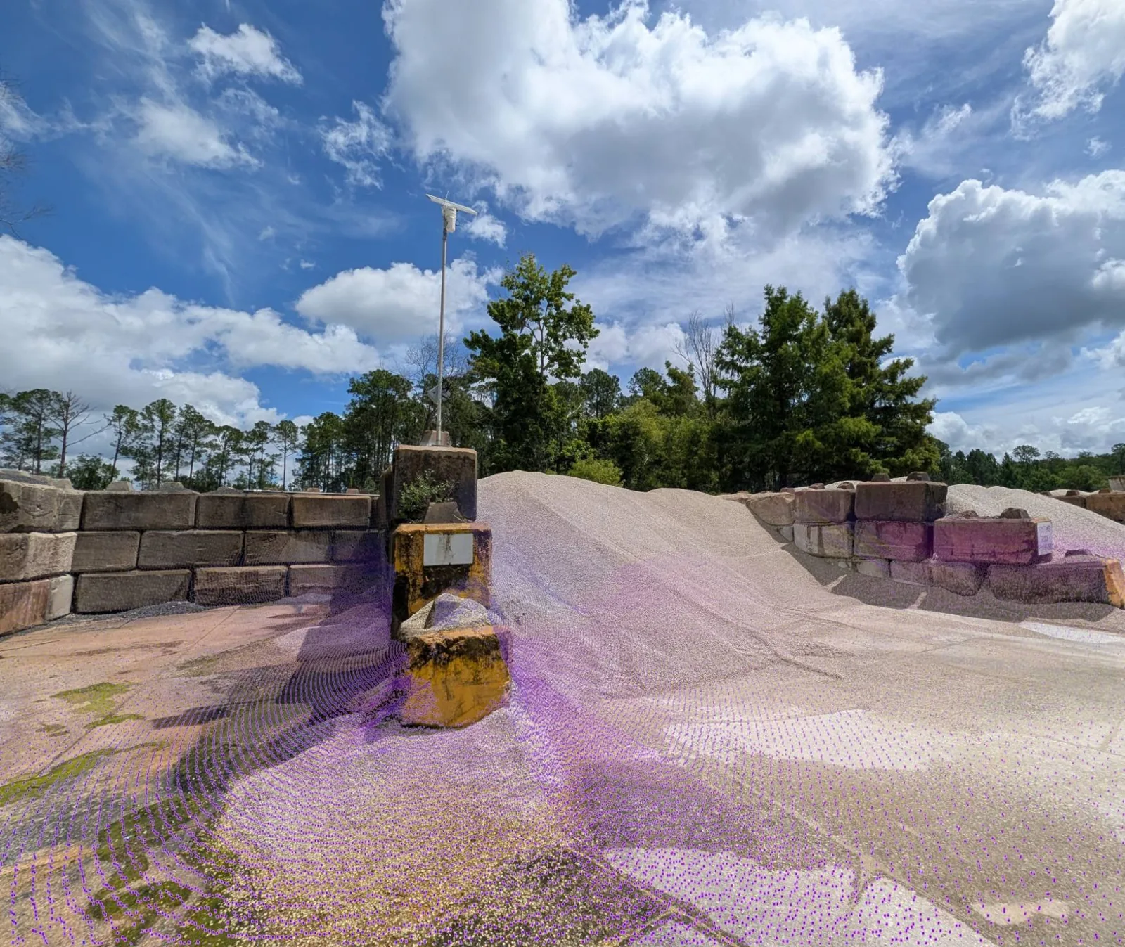
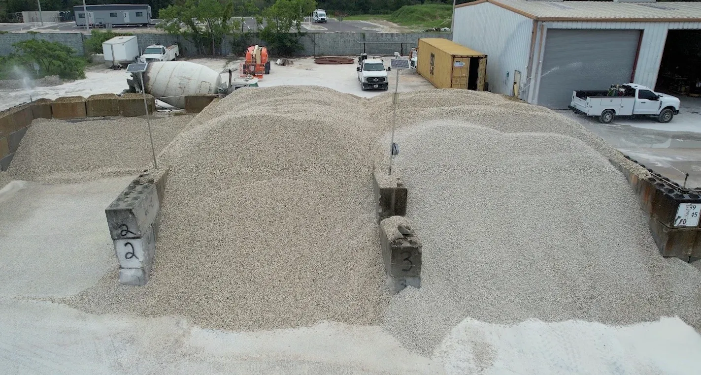
Before and after
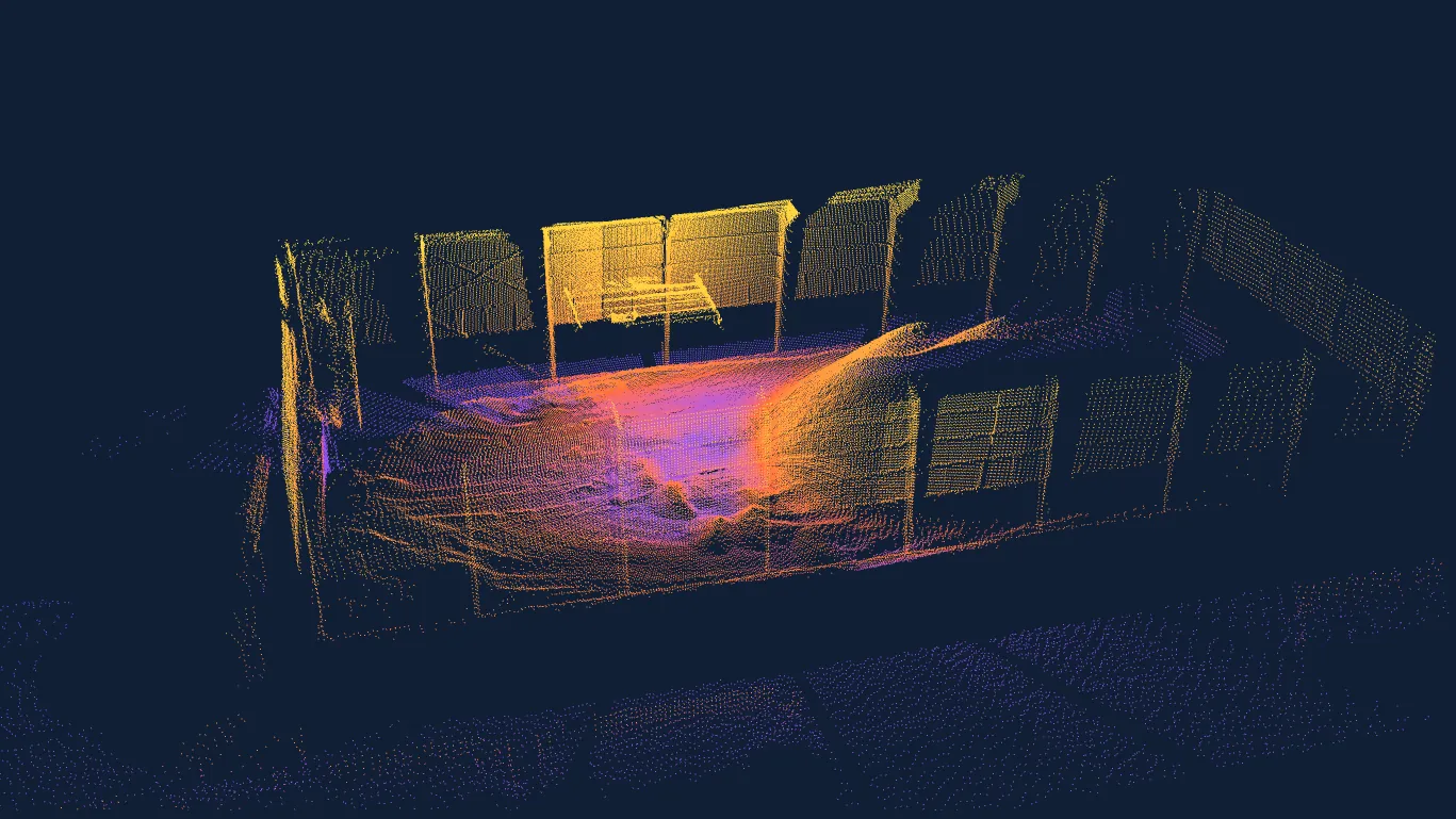
From raw site to measured 3D point cloud
A digital twin that supports precise measurement, change detection and analysis of your most important spaces and assets.
Interactive 3D
Explore a real EOS2 LiDAR scan
This is raw point cloud data captured by an EOS2 sensor, rendered live in your browser and colored by height. Rotate, zoom and pan to inspect every point.
Loading 3D model… (2.1 MB)
Features
EOS2 key features
A new category of affordable LiDAR sensor. The EOS2 combines long-range scanning, a spherical field of view, low power draw, wireless communications and a rugged enclosure at a price that enables projects instead of stalling them.
Full spherical coverage
A 360° x 180° field of view captures floors, walls, ceilings and every pile in the room from a single mount point.
Long range
100–200 ft in every direction per scanner (200–400 ft across) depending on material visibility. Merge point clouds from several sensors for unlimited system coverage.
Low power, solar ready
12 VDC with 25 mA idle and 500 mA scanning draw, low enough for solar-powered installations far from utility power.
Wireless communications
2.4 GHz Wi-Fi and Bluetooth. No data cabling to run across a yard or through a storage building.
Built for permanent mounting
IP54 enclosure (dust protected, splash resistant) a standard 3/4" NPT mount and a 1/4"-20 UNC thread for top mounting, for indoor or outdoor installation.
Eye-safe Class 1 laser
Safe to operate around people and equipment during normal operations. No need to clear the area to scan.
Specifications
EOS2 LiDAR sensor technical specifications
| Power | 12 VDC: 2 A peak, 500 mA scanning, 25 mA idle |
|---|---|
| Mounting | 3/4" NPT; 1/4"-20 UNC thread for top mounting |
| Communication | 2.4 GHz Wi-Fi, Bluetooth |
| Ingress protection* | IP54 |
| Field of view | 360° x 180° (full sphere) |
| Scan time | About 3 minutes for a full sphere at 1° angular resolution |
| Angular accuracy | 0.25° |
| Rangefinder accuracy | 1% |
| Per-scanner range** | 100–200 ft radius (200–400 ft across) |
| System range*** | Unlimited |
| Laser safety | Class 1, eye-safe |
* Dust protected; protected against water splashed from all directions. ** Depending on material visibility. *** With point-cloud merging.
See it in action
The EOS2 sensor and Hyperion at work
Watch the EOS2 LiDAR sensor and Hyperion deliver fast, automated volumetric measurement. In minutes the sensor generates a precise 3D point cloud, and Hyperion turns it into a visual, quality-checked inventory report, with no one on the pile.
Acquire a sensorPricing
EOS2 hardware pricing
Buy the sensor outright or lease it with monitoring and replacements included. Please inquire for bulk pricing.
Purchase
Hardware owned and maintained by you. Easy integration with Hyperion.
- 1-year hardware warranty
- Use with Hyperion or export point clouds to your own tools
Lease
We handle the hardware and make sure it is working properly.
- Hardware health monitoring by Altamus, targeting 100% uptime
- Lifetime hardware updates
- Lifetime hardware replacement while your plan is active
Hyperion software is priced separately. See Hyperion plans.
Works best with Hyperion
Turn EOS2 point clouds into inventory answers
The EOS2 captures the 3D data; Hyperion brings it to life. Hyperion schedules scans hourly, daily or on demand, merges and registers point clouds from multiple sensors, filters out noise and equipment, and calculates quality-checked volumes within minutes.
- Native tools to stitch several EOS2 scanners into one seamless model
- 3D models, height maps and volume trends in a web dashboard
- Tonnage from lab-verified bulk densities, with API export to ERP and BI tools
At a Newberry, Florida cement plant, four EOS2 sensors on overhead trusses measured an indoor coal pile within 0.55% of a certified terrestrial survey, with scanning and processing completed in under 20 minutes.
Explore Hyperion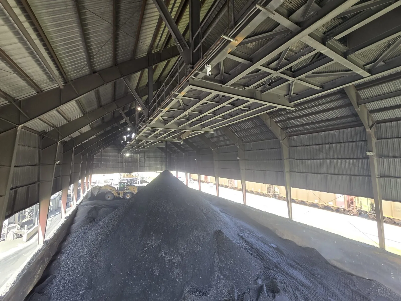
EOS2 LiDAR sensor FAQ
Answers to common questions about the EOS2 sensor.
The EOS2 completes a full 360° spherical scan in about 3 minutes, producing a point cloud at 1° angular resolution. That makes it practical to scan frequently, whether on a schedule or on demand.
Each EOS2 reaches 100 to 200 feet in every direction (200 to 400 feet across), depending on the visibility of the material being scanned. For larger sites, point clouds from multiple scanners are merged into one seamless model with unlimited system coverage. The tools for stitching are built into Hyperion.
Yes. The EOS2 is optimized for Hyperion, but you can export point clouds and work with them in other 3D analysis and mapping tools, including open-source applications such as CloudCompare and MeshLab. See point cloud generation with the EOS2 for examples.
With a lease, Altamus monitors hardware health and provides lifetime hardware replacement while your plan is active. Purchased sensors include a 1-year hardware warranty, after which ongoing maintenance is your responsibility.
No. The EOS2 can operate locally through its companion application over Wi-Fi or Bluetooth. An internet connection and a Hyperion account are recommended if you want remote access to your data, alerts or cloud-based tools.
Yes. The IP54 enclosure is dust protected and resists water splashed from any direction, and the standard 3/4" NPT mount attaches to poles, trusses and beams, with a 1/4"-20 UNC thread for top mounting. Its low power draw makes solar-powered installations practical.
Explore more
Contact
Acquire an EOS2 sensor
Tell us what you want to scan, how large the area is and whether you plan to use Hyperion, and we will recommend the number of sensors and a mounting layout.
- +1 352-283-8003
- info@altamusinc.com
- 4936 SW 91st Ter M102
Gainesville, FL 32608