EOS2 Applications
LiDAR point cloud generation, now within reach
The EOS2 is a low-cost 3D LiDAR scanner for explorers, students, researchers and makers. Capture a full 360° point cloud in about three minutes and take real 3D data into the tools you already use.
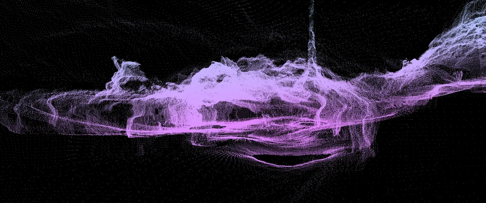
What will you create?
Affordable LiDAR point cloud generation for real projects
Long-range LiDAR has traditionally been priced for industrial survey work. The EOS2 changes the math. At $2,750 per scanner, it puts spherical 3D capture within reach of a university lab, a caving club or a developer's workbench.
Each scan sweeps a full 360° x 180° sphere at 1° angular resolution, reaching 100–200 ft in every direction (200–400 ft across) depending on the surface. The sensor runs on 12 VDC, talks over Wi-Fi and Bluetooth, and lives in an IP54 enclosure that shrugs off dust and splashing water. Scan from several positions and merge the results for areas larger than a single sensor can see.
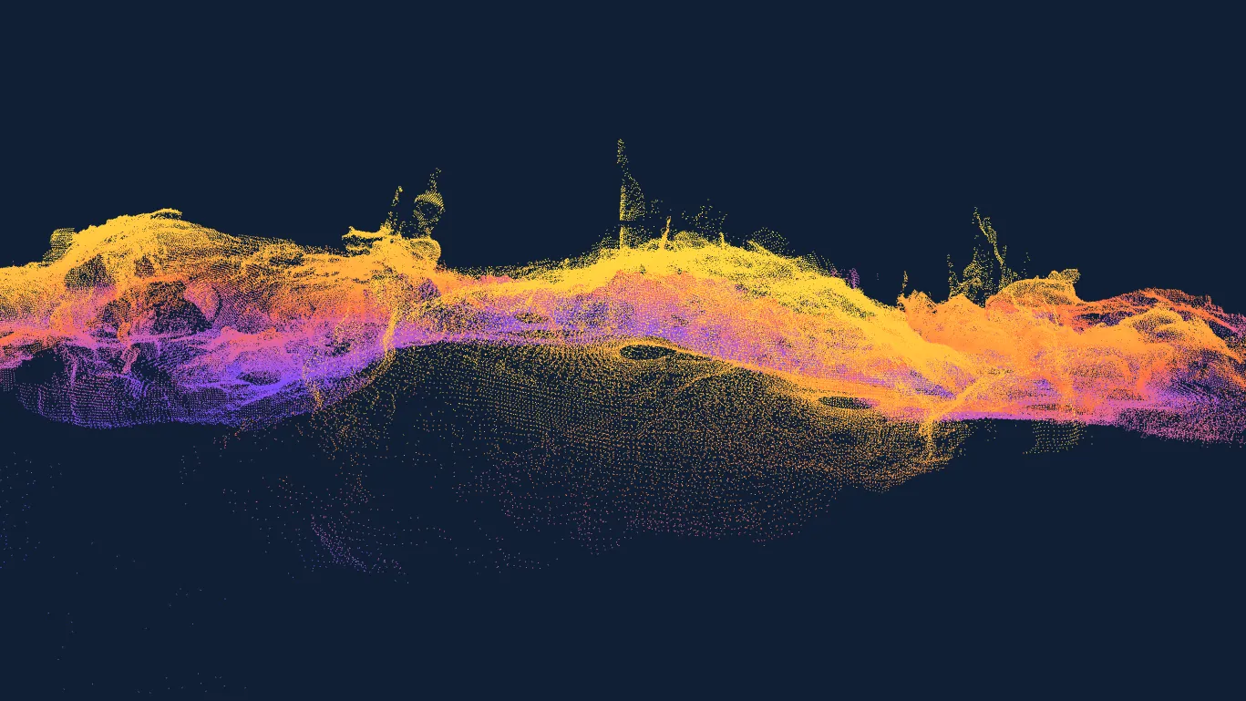
The output is a standard point cloud: raw 3D data you can measure, mesh, render, 3D print or drop into a game engine.
Audiences
Who uses the EOS2 for 3D capture?
Built for curiosity, not just heavy industry.
Explorers and hobbyists
Keep a 3D record of caves, forests and terrain. Create models to print, share online or walk through in virtual reality.
Students and educators
Real, accessible hardware for 3D capture, GIS and architecture labs, so projects are built on real-world data instead of samples.
Makers and developers
Feed 3D data into custom scanning rigs, robotics experiments or interactive art installations, and build your own processing pipeline.
Case study
Mapping the Bat Cave on a hobbyist budget
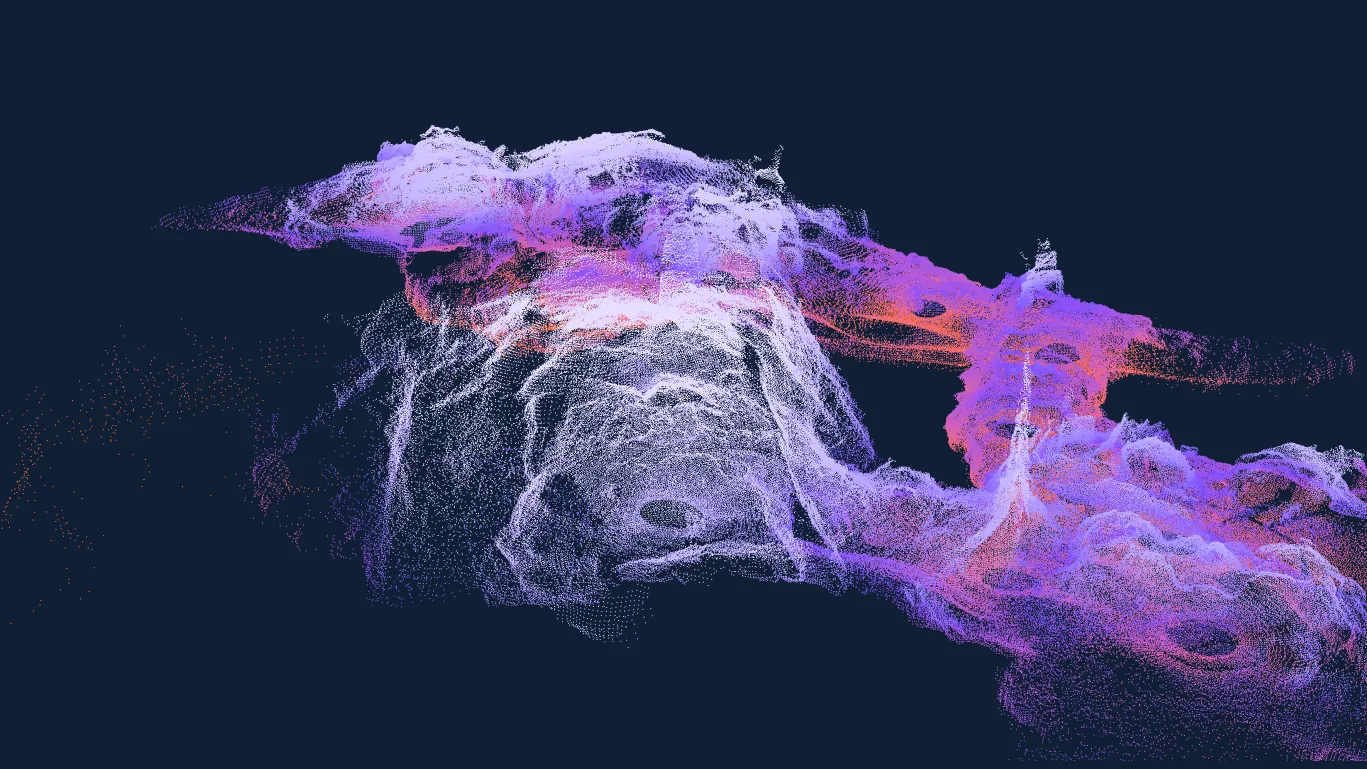
The only map of the Bat Cave was a flat diagram on a sign. A small team carried a portable EOS2 through the cave, scanning at each stop, and stitched nearly 600,000 points into a measurable 3D model of the whole system. Rotate the result in the viewer below.
Read the Bat Cave case studyInteractive 3D
Explore the 3D scans
Real point clouds captured with the EOS2 LiDAR sensor, rendered live in your browser. This is the raw data you get.
The full cave model, stitched from scans taken at each stop. Follow the passages and ceiling structure in 3D.
Loading 3D model… (7.3 MB)
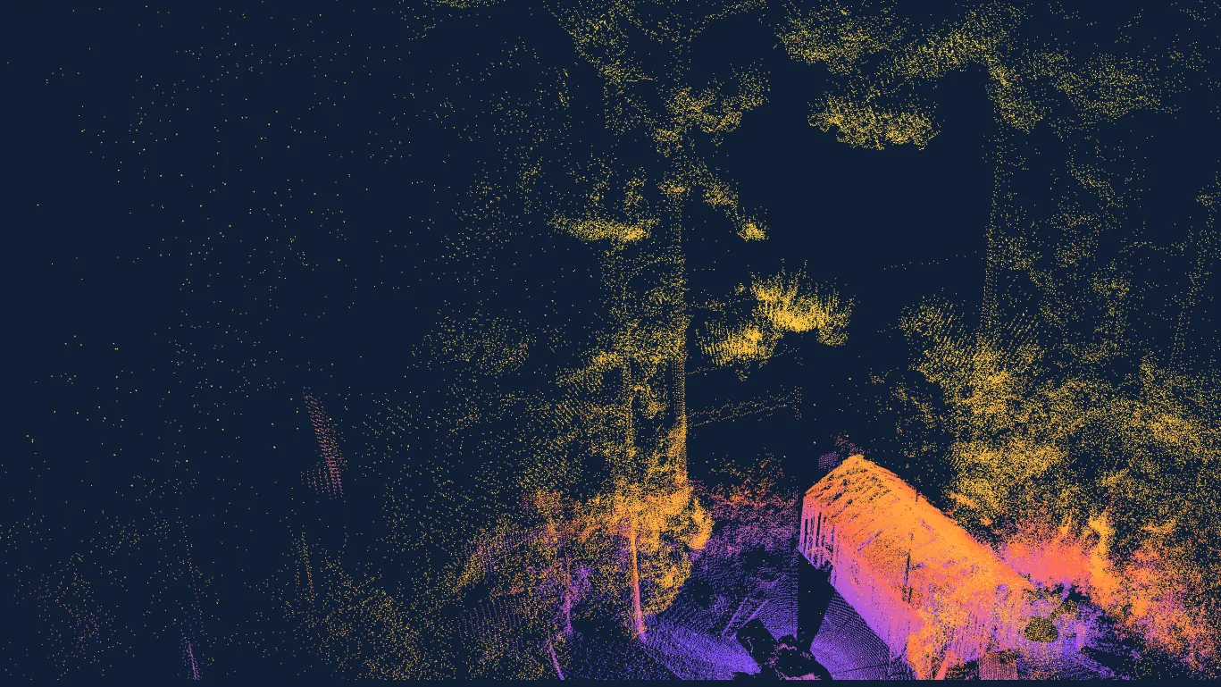
Ground terrain, trees and the house captured together, ready for measuring and planning a build.
Loading 3D model… (3.6 MB)
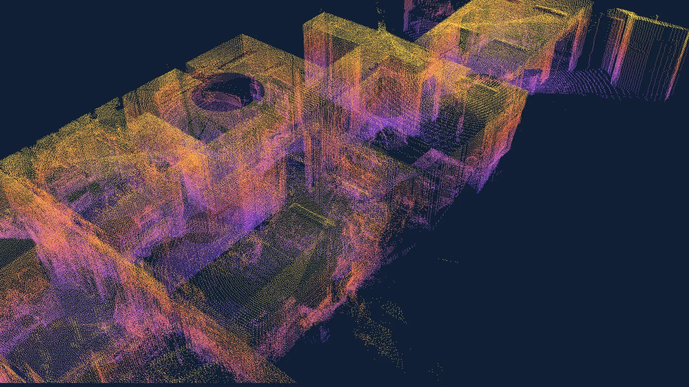
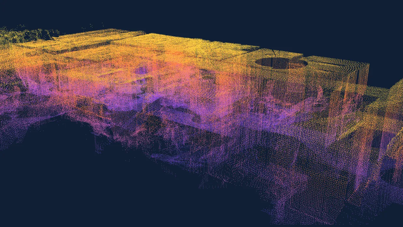
Our own office, merged from several scan positions. A good dataset for interior planning and asset creation.
Loading 3D model… (6.9 MB)
Education
A 3D lab at your fingertips
For digital design labs, GIS classes and architecture programs, the EOS2's price makes it realistic to put a long-range LiDAR sensor in students' hands. They can capture real objects, interiors and outdoor environments and turn them into detailed 3D models.
It is a practical way to learn how point clouds work: registration, filtering, meshing and measurement. Students can also create custom assets for 3D printing, game development and virtual reality projects.
The scan shown here is our own office, captured from several positions and merged into one interior point cloud.
Your workflow
Software compatibility
The EOS2 produces standard point clouds, so you can work with them in Hyperion or in widely used free and open-source tools.
CloudCompare
Open-source point cloud analysis and visualization: clean, align, compare and measure scans.
MeshLab
Open-source processing to turn point clouds into 3D meshes ready for printing or modeling.
Blender
Import scans for rendering, animation and 3D modeling projects.
Unity and Unreal Engine
Use a scanned cave or backyard as a level in a game or an immersive VR scene.
Hyperion
Altamus software to clean, visualize and measure point clouds, including volume calculations.
3D printing
Mesh a scan and print a physical scale model of a cave, building or landscape.
Works best with Hyperion
Clean, visualize and measure your scans
The EOS2 captures the 3D data; Hyperion helps you bring it to life. Merge scans from multiple positions, filter out noise and measure what matters, whether that is the volume of a backyard excavation, the interior of a room or a complex dataset for a school project.
Point cloud generation FAQ
Quick answers for creators, students and researchers.
No. It was designed with simplicity in mind. The sensor connects wirelessly over Wi-Fi or Bluetooth and runs locally through its companion application, so you can start a scan and get a point cloud in minutes. If you have worked with an Arduino or Raspberry Pi, you will feel at home.
Besides Hyperion, there are many free options. EOS2 point clouds can be opened in open-source tools such as CloudCompare for analysis and visualization and MeshLab for processing and meshing. You can also import the data into Blender, Unity or Unreal Engine for creative projects.
A full 360° x 180° scan at 1° angular resolution takes about three minutes. Each scan reaches 100–200 ft from the scanner (200–400 ft across) depending on how visible the surfaces are. For larger areas, scan from several positions and merge the point clouds.
Once you process the point cloud into a 3D mesh, you can 3D print a physical model of a cave or house, use it as a level in a video game, or import it into virtual reality software to walk inside your scan.
Traditional long-range LiDAR scanners are built and priced for industrial survey work. The EOS2 focuses on the features that permanent monitoring, research and maker projects need: spherical coverage, useful range, low power and wireless data. It is available to purchase for $2,750 per scanner or to lease for $100 per scanner per month.
Contact
Ready to start scanning?
Tell us about your project, whether it is a cave, a classroom or a custom rig, and we will help you get set up with an EOS2.
- +1 352-283-8003
- info@altamusinc.com
- 4936 SW 91st Ter M102
Gainesville, FL 32608